- Home
- The Amalfi Coast
The Amalfi Coast
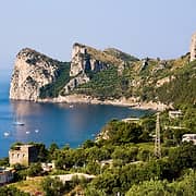
The Amalfi Coast, in the Campania region of southern Italy, extends geographically from Punta Campanella on the southern edge of the Sorrentine Peninsula to the town of Vietri sul Mare. The coast is located just over 30 miles south of Naples and north of the Cilento peninsula, with Salerno sitting to the far east. The landscape is made up of limestone cliffs, Mediterranean brush, coves cut into the coastline, and small towns and villages perched on the cliffs.
What are the 13 towns of the Amalfi Coast?
There are 13 towns and villages on the Amalfi Coast: Amalfi, Atrani, Cetara, Conca de' Marini, Furore, Maiori, Minori, Positano, Praiano, Ravello, Scala, Tramonti, and Vietri sul Mare.
The coastal towns
Almost all the coastal towns are located along the SS163 (Amalfitana) highway, which begins in the hills of Piano di Sorrento and ends in Vietri sul Mare, an old fishing village. The town of Amalfi is about halfway along the highway, which was built between 1832 and 1850. Before that time, there were only rough mule tracks running between the villages, which today are used as breathtaking hiking trails (including the famed Path of the Gods). It takes about 90 minutes to drive from one end of the Amalfi Coast to the other, if you don't stop to visit any of the small towns or snap photos of the breathtaking vistas along the way!
The hill towns
To visit Ravello, Tramonti, Furore, and Agerola, you need to take the one of the roads that climbs the slopes of the Lattari Mountains. The most striking characteristic of the Amalfi Coast is its steep landscape with tiny fishing villages perched over the water's edge, towering cliffs, and hidden grottos along the shore. Many of these small towns have more flights of stairs than the number of streets in their historic centers.
UNESCO World Heritage site
The entire Amalfi Coast was designated as a UNESCO World Heritage Site in 1997 due to its exceptional cultural landscape. The designation highlights the area's unique topography, which has allowed for the cultivation of crops such as the famous Amalfi lemons and vineyards, while also preserving the natural beauty of the Mediterranean landscape. The historical significance of the Amalfi Coast is rooted in its past as a powerful maritime republic from the 9th to the 13th centuries, which played a crucial role in Mediterranean trade and cultural exchange. The architectural influences from various civilizations, including Roman, Greek, and Arab cultures, are evident in the region's buildings and urban planning, particularly in towns like Amalfi and Positano. This blend of natural beauty and rich history makes the Amalfi Coast not only a stunning tourist destination but also a site of great cultural importance.


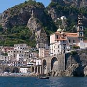
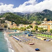
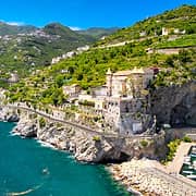
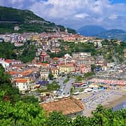
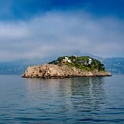
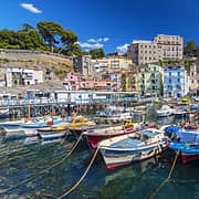
Positano
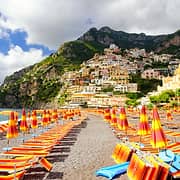
Positano is famous for its colorful houses that cling to the cliffs, offering breathtaking views and a romantic atmosphere.
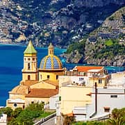
Pros: The spectacular scenery and romantic atmosphere make it a popular destination. The beaches of Spiaggia Grande and Fornillo are beautiful and there are numerous scenic trails to explore. It offers a great selection of boutiques, local crafts, art galleries and restaurants. It is the quintessential Amalfi Coast as one imagines it, like the endless postcards with the majolica dome of the Church of Santa Maria Assunta.
Cons: The prices for hotels, restaurants, and beach clubs are very high. Getting around the historic center requires navigating lots of staircases, which can be difficult for people with reduced mobility. In addition, during the summer, Positano can be extremely crowded.
Positano is perfect for couples who want a romantic and glamorous atmosphere.
Praiano
Praiano is a picturesque fishing village located between Positano and Conca dei Marini, known for its rugged coastline and authentic atmosphere.
Pros: The town offers spectacular views and beautiful beaches such as Marina di Praia. It's calm and quiet, with long-standing local traditions and a welcoming community. In addition, you can explore the natural beauty of the Amalfi Coast by walking the scenic trails located nearby.
Cons: Many attractions are only accessible via long staircases, making it less suitable for those with mobility issues. There's a limited choice of restaurants and activities compared to more touristy towns such as Positano. In addition, there isn't much nightlife.
Praiano is ideal if you're looking for a calm and quiet atmosphere.
Amalfi
Amalfi is the historic heart of the Amalfi Coast, famous for its cathedral and traditional paper mills.
Pros: This town is filled with history and culture, with lots of tourist attractions such as the Paper Museum, the Cathedral dedicated to St. Andrew the Apostle, the ironworks, and the Valley of the Mills. It's well-connected by transport to other towns on the coast, which makes it easy to explore the surrounding areas. Amalfi also offers a wide variety of dining and shopping options.
Cons: Amalfi can get chaotic during the high tourist season. The beaches are small and can be crowded. Prices also tend to be on the higher side compared to other towns.
Amalfi is best suited to tourists who are interested in culture and history.
Ravello
Located high up on the coast, Ravello is known for its historic gardens, once loved by Wagner, and breathtaking views.
Pros: The spectacular views from Villa Rufolo and Villa Cimbrone are a big draw for visitors. The tranquil atmosphere makes Ravello ideal for relaxation. It's also famous for musical events and the Ravello Festival, which attracts visitors from all over the world.
Cons: Ravello is less accessible than lower-lying coastal towns. Nightlife is limited compared to other areas of the Amalfi Coast. In addition, it's not close to the shore, which may disappoint those looking for a beach holiday.
Ravello is best for couples who want a calm atmosphere and cultural experiences.
Conca de' Marini
Conca dei Marini is a small town near Amalfi, famous for the Emerald Grotto and its traditional white houses perched on the rock.
Pros: The town has a quiet and relaxed atmosphere, far from mass tourism, making it ideal for those looking for a peaceful stay. The beaches, such as Marina di Conca, are picturesque and accessible, with restaurants offering local specialties.
Cons: The choice of restaurants and activities is limited compared to larger towns. Additionally, public transportation can be a challenge, as you have to pass through Amalfi to reach other towns on the coast. In addition, some local attractions are only accessible via long flights of steps.
Furore
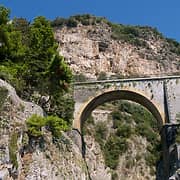
Furore is a small town on the Amalfi Coast famous for its spectacular fjord and breathtaking views.
Pros: The natural beauty of the Furore Fjord is undoubtedly the town's biggest attraction. There's a long staircase from the fjord that takes you to the town itself, which is located high above the sea. In addition, Furore has a great selection of excellent restaurants.
Cons: Furore is geographically isolated, which can make access to public transport and other towns on the coast difficult. The narrow streets and steep climbs are quite challenging.
Atrani
With a surface area of just 0.9 km², Atrani is the smallest town in Italy, offering a cozy and intimate atmosphere.
Pros: The town is characterized by unique architectural beauty with Baroque buildings and a piazza surrounded by porticos. It has a small sandy beach and is very close to more famous towns such as Amalfi and Ravello.
Cons: The narrow streets and steps can be challenging for those with mobility difficulties. Also, Atrani's location close to Amalfi makes it crowded during high season.
Minori
Minori is a quaint little village with a beautiful beach, ideal for families.
Pros: The beach is accessible and calm, making it perfect for families with children. There's an authentic and relaxed atmosphere, giving visitors a more genuine experience compared to touristy resort areas. Minori is close to Maiori, so it gives visitors more options for entertainment.
Cons: Minori has fewer amenities than larger resort towns such as Sorrento and Amalfi. The main tourist attractions are limited and there isn't much nightlife.
Maiori
Maiori boasts the longest beach on the Amalfi Coast and is ideal for a seaside holiday. The municipal area also includes the charming village of Erchie.
Pros: The large and accommodating beach with various beach clubs is a real plus for anyone who loves the seaside. Maiori also offers easy access to local shops and restaurants. It's also a good departure point for excursions in the surrounding area.
Cons: Maiori can be less picturesque than other area villages such as Positano or Ravello. This is because in 1954 it was completely destroyed by a flood and was later rebuilt in a modern style. It can also become crowded during high season.
Vietri sul Mare
Vietri sul Mare is famous for its handcrafted ceramics and is considered the gateway to the Amalfi Coast.
Pros: The beautiful local ceramics make a great souvenir to take home. There are ample beaches with relaxing beach clubs, making it a welcoming seaside destination. The lively atmosphere with traditional restaurants lets you savor local cuisine.
Cons: Vietri doesn't have many significant historical attractions to visit and its landscape makes it less characteristic than other towns on the coast.
Cetara
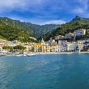
Cetara is a fishing village located along the Amalfi Coast, known for its culinary traditions, in particular the production of a traditional Italian fish sauce made from anchovies called colatura di alici. The village is characterized by colorful houses overlooking a crystal-blue sea.
Pros: Cetara's natural beauty is accentuated by its beaches, such as Marina Beach and Spiaggia degli Innamorati, which are ideal for swimming and relaxing. The village is also famous and beloved by locals for its excellent restaurants.
Cons: Cetara is located far from the more famous resort towns along the Amalfi Coast. Despite this, its beaches can become crowded during high season, which makes it feel much less secluded. It also doesn't have much nightlife.
Nerano
Nerano is a picturesque fishing village on the Amalfi Coast, known for its natural beauty and crystal-clear waters. This quiet town is famous for its beautiful beaches and local cuisine.
Pros: Marina del Cantone Beach is one of Nerano's main attractions, offering an ideal setting for swimming and sunbathing. The restaurants on the beach are famous for their traditional dishes and delicious dishes. The village is surrounded by green hills and scenic trails.
Cons: Nerano is isolated from other towns on the Amalfi Coast, with limited public transportation. With a car it takes about 30 minutes to reach the nearest town. During high season, the beach can get crowded.
Sant'Agata sui Due Golfi
Sant'Agata sui Due Golfi is a charming village located on a cliff that offers splendid views of both the Gulf of Naples and the Gulf of Salerno. It's famous for its panoramic position and cooler climate.
Pros: The town offers numerous hiking trails, making it perfect for nature lovers and hikers. Sant'Agata is also known for its excellent cuisine, where you can choose from Michelin-starred restaurants as well as traditional trattorias.
Cons: From Sorrento and Positano it takes 30 minutes by car to reach the village, making it rather isolated. In addition, getting around by public transport can be challenging.
Tramonti
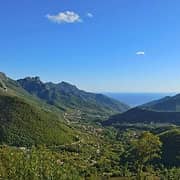
Tramonti is an inland village along the Amalfi Coast. It's known for its mountainous landscapes and farming traditions. This village is famous for its wine production and traditional local food specialties, such as buffalo mozzarella.
Pros: Tramonti's location offers spectacular views of the hills as well as an atmosphere of absolute peace and quiet. With the area's hiking trails you can explore the Parco dei Monti Lattari nature preserve. Many local wineries offer tastings of fine wines. In addition, Tramonti is less crowded than the towns on the coast, which makes for a more authentic local experience.
Cons: Tramonti is located quite far from the seashore and the coastal towns and public transport is limited, so you'll most likely need to rent a car.
Agerola
Agerola is located in the Lattari Mountains, about 600 meters above sea level. It's known for its natural beauty and peaceful atmosphere. Often called "the gateway to the Divine Coast", it's surrounded by hiking trails and offers spectacular views of the gulfs of Naples and Salerno.
Pros: Agerola's main attraction is the famous Sentiero degli Dei, a scenic hiking trail with breathtaking views of the Amalfi Coast. The town is ideal for hiking enthusiasts, with numerous trails that pass through mountain landscapes and green valleys. Agerola is also known for its culinary traditions, especially local production of fiordilatte mozzarella and dishes made with fresh local ingredients.
Cons: Agerola is isolated from the more touristy coastal towns, with fewer dining and entertainment options. It's just under 10 miles away from the beaches. Public transportation can be limited, so you'll need a car to explore the area.
Sorrento
Sorrento is a lively resort town on the Amalfi Coast with plenty of tourist amenities. It's famous for its stunning views of the Bay of Naples and is a great base for exploring the surrounding area.
Pros: The town offers a wide range of restaurants, shops and accommodations, making it very convenient for tourists. There's a wide range of transport options both by land and sea to get to Naples, Capri, Pompeii and other popular destinations along the coast. In addition, there are spectacular and easily accessible scenic views of the bay.
Cons: Sorrento is part of the Sorrento Peninsula, not the Amalfi Coast, so it's a bit more urban in character. Traffic can be a problem during high season.
Main distances chart
Route | Average Travel Times – Private Transfer | Average Travel Times – Public Transport |
|---|---|---|
Napoli - Capri | 40-50 minutes (private hydrofoil) | 2 hours (metro + public ferry) |
Napoli - Ischia | 50-60 minutes (private hydrofoil) | 2 hours (metro + public ferry) |
Napoli - Procida | 30-40 minutes (private hydrofoil) | 2 hours (metro + public ferry) |
Napoli - Sorrento | 1 hour 15 minutes (private car) | 1 hour (Circumvesuviana or bus) |
Napoli - Positano | 1 hour 30 minutes (private car) | 2 hours 15 minutes (Circumvesuviana + bus) |
Napoli - Amalfi | 1 hour 40 minutes (private car) | 2 hours 40 minutes (Circumvesuviana + bus) |
Napoli - Roma | 2 hours 30 minutes (private car) | 1 hour 10 minutes (high-speed train) |
Roma - Sorrento | 3 hours 30 minutes (private car) | 3 hours (high-speed train + Circumvesuviana) |
Sorrento - Capri | 20-25 minutes (private hydrofoil) | 30-45 minutes (public ferry) |
Sorrento - Positano | 30-40 minutes (private car) | 1 hour 15 minutes (bus) |
Sorrento - Amalfi | 1 hour (private car) | 1 hour 30 minutes (bus) |
Sorrento - Ischia | 50-60 minutes (private hydrofoil) | 1 hour 45 minutes (public ferry) |
Positano - Amalfi | 30 minutes (private car) | 1 hour (bus or ferry) |
Positano - Capri | 40-45 minutes (private speedboat) | 1 hour 30 minutes (public ferry) |
Positano - Ischia | 1 hour (private speedboat) | 2 hours 15 minutes (public ferry) |
Amalfi - Capri | 45-50 minutes (private speedboat) | 1 hour 40 minutes (public ferry) |
Amalfi - Ischia | 1 hour (private speedboat) | 2 hours (public ferry) |
Salerno - Positano | 1 hour (private car) | 1 hour 40 minutes (bus or ferry) |
Salerno - Amalfi | 45 minutes (private car) | 1 hour 30 minutes (bus or ferry) |
Salerno - Capri | 1 hour (private speedboat) | 2 hours (public ferry) |
Which locations on the Amalfi Coast are best for couples?
Which locations on the Amalfi Coast are best for couples?
Positano and Ravello are two of the most romantic destinations on the Amalfi Coast, ideal for couples. In Positano, the atmosphere is enchanting, with luxury hotels and restaurants with terraces overlooking the sea, perfect for a candlelit dinner. It also offers several beach clubs to relax and is the perfect departure point for boat trips.
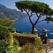
Ravello, on the other hand, is famous for its gardens and panoramic views. The Terrazza dell'Infinito (Infinity Terrace) at Villa Cimbrone offers stunning views of the sea, while the surrounding terraced gardens are ideal for intimate moments. Ravello is a place where couples can enjoy tranquility and natural beauty, making it a perfect choice for those looking for a more serene and contemplative experience, away from the crowds.
Which places on the Amalfi Coast are best suited for families?
Which places on the Amalfi Coast are best suited for families?
The Amalfi Coast isn't generally recommended for families with small children due to its rocky beaches and many steps. However, there are some places where it's easier and more comfortable to stay with children.
Minori and Maiori are both flat and therefore good choices for families. They both have small public beaches that are easily accessible from the boardwalk and have amenities available such as sun loungers and umbrellas. In addition, restaurants and shops are close by, making for a stay that's easier and more comfortable when traveling with little ones.
Amalfi is well-connected to the other towns along the coast and offers numerous attractions for children, such as a playground near the port and the Paper Museum, which organizes guided tours. There are a variety of boat trips that depart from the port making for an activity that's sure to delight children.
What town is a good base for exploring the Amalfi Coast?
What town is a good base for exploring the Amalfi Coast?
Recommended towns to use as your home base when you stay on the Amalfi Coast include:
Amalfi: Central location with good transport links.
Positano: Known for its vibrant atmosphere and beaches.
Ravello: Offers a quieter experience with beautiful gardens but no beaches.
What are some key things to see and do on the Amalfi Coast?
What are some key things to see and do on the Amalfi Coast?
Visit the Amalfi Cathedral (Duomo) in Amalfi.
Take in the scenic views from Ravello's villas, Villa Cimbrone and Villa Rufolo.
Wander through the picturesque streets of Positano, famous for its pastel-colored houses that cascade down steep cliffs to the Mediterranean Sea.
Discover the local handcrafted ceramics culture in Vietri sul Mare, which has a long-standing tradition of ceramic production that dates back over a thousand years.
Hike the Path of the Gods (Sentiero degli Dei), a renowned walking path located between the villages of Bomerano in Agerola and Nocelle, which is situated above Positano.
What unique local specialties should I try on the Amalfi Coast?
What unique local specialties should I try on the Amalfi Coast?
Sample local flavors such as lemon-infused dishes and pastries like Delizia al Limone as well as the famous lemon liqueur known as limoncello. In Cetara, make sure to sample the traditional anchovies. In the fishing village of Nerano, be sure to try Spaghetti alla Nerano, a pasta dish made with fried zucchini and cheese.
Do I need to have a car to travel around the Amalfi Coast?
Do I need to have a car to travel around the Amalfi Coast?
In order to visit some of the smaller villages along the Amalfi Coast that aren't serviced by public transport (such as Furore and Vietri sul Mare, for example) you'll need to have a car.
However, staying on the Amalfi Coast without a car is feasible. Key towns like Amalfi and Positano are well-serviced by public transportation (buses and ferries), making it easy to explore without needing a vehicle.
When is the best time to visit the Amalfi Coast?
When is the best time to visit the Amalfi Coast?
The best time to visit the Amalfi Coast is during what are known as the "shoulder seasons" in spring (April and May) and fall (September to October). During these times, the weather is pleasant and crowds are smaller compared to the peak summer months. Winter is best avoided since many restaurants and hotels that are only open seasonally remain closed.
What are the best towns on the Amalfi Coast for nature lovers?
What are the best towns on the Amalfi Coast for nature lovers?
Praiano serves as a great base for hikers, with the famous Sentiero degli Dei (Path of the Gods) starting here, offering breathtaking views of the Tyrrhenian Sea and surrounding landscapes. Ravello is famous for its lush gardens and stunning vistas. Villa Cimbrone and Villa Rufolo feature beautifully manicured gardens that provide serene spots to relax while enjoying panoramic views of the coastline. Known for its dramatic fjord, Furore offers a picturesque setting with colorful houses nestled in the cliffs. It’s less touristy than other towns, making it ideal for those seeking a quieter experience surrounded by nature.
What are some must-see historical sights on the Amalfi Coast?
What are some must-see historical sights on the Amalfi Coast?
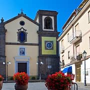
The cathedral in Amalfi, known as the Duomo, dates back to the 9th century and is known for its impressive Arab-Norman architecture. The adjacent Chiostro del Paradiso (Cloister of Paradise) is also worth a visit for its serene atmosphere and beautiful architecture. In Ravello, Villa Rufolo is a historic villa originally built in the 13th century, with gardens that offer breathtaking views of the coastline. The Church of Santa Maria Assunta in Positano is famous for its colorful dome and houses a Byzantine icon of the Black Madonna.
What local food specialties should I try on the Amalfi Coast?
What local food specialties should I try on the Amalfi Coast?
In Nerano, try the traditional pasta dish "Spaghetti alla Nerano," which consists of spaghetti tossed with sautéed zucchini and Provolone cheese. In Cetara, try the "alici di Cetara," which are anchovies prepared in various ways—fried, marinated, or brined—and often served as an appetizer. A dish that originated in Praiano is called "Totani e Patate alla Praianese," which features calamari rings braised with potatoes in red wine sauce. As for sweets, make sure to sample Delizia al Limone, a lemon-flavored cake that highlights the region's famous lemons, or Pastiera, a traditional Neapolitan Easter pie made with ricotta cheese and wheat.
More information on